6.1 Polygon maps
Perhaps the simplest approach to drawing maps is to use geom_polygon() to draw boundaries for different regions. For this example we take data from the maps package using ggplot2::map_data(). The maps package isn’t particularly accurate or up-to-date, but it’s built into R so it’s an easy place to start. Here’s a data set specifying the county boundaries for Michigan:
mi_counties <- map_data("county", "michigan") %>%
  select(lon = long, lat, group, id = subregion)
head(mi_counties)
#>     lon  lat group     id
#> 1 -83.9 44.9     1 alcona
#> 2 -83.4 44.9     1 alcona
#> 3 -83.4 44.9     1 alcona
#> 4 -83.3 44.8     1 alcona
#> 5 -83.3 44.8     1 alcona
#> 6 -83.3 44.8     1 alcona
In this data set we have four variables: lat and long specify the latitude and longitude of a vertex (i.e. a corner of the polygon), id specifies the name of a region, and group provides a unique identifier for contiguous areas within a region (e.g. if a region consisted of multiple islands). To get a better sense of what the data contains, we can plot mi_counties using geom_point(), as shown in the left panel below. In this plot, each row in the data frame is plotted as a single point, producing a scatterplot that shows the corners of every county. To turn this scatterplot into a map, we use geom_polygon() instead, which draws each county as a distinct polygon. This is illustrated in the right panel below.
ggplot(mi_counties, aes(lon, lat)) +
  geom_point(size = .25, show.legend = FALSE) +
  coord_quickmap()

ggplot(mi_counties, aes(lon, lat, group = group)) +
  geom_polygon(fill = "white", colour = "grey50") +
  coord_quickmap()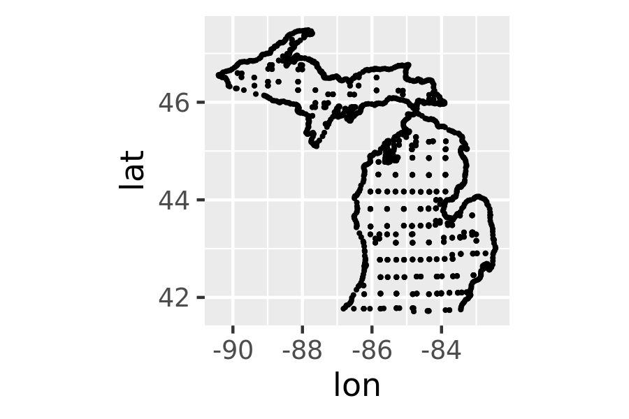
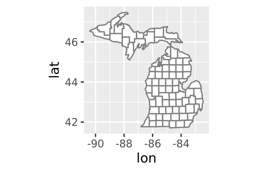
In both plots I use coord_quickmap() to adjust the axes to ensure that longitude and latitude are rendered on the same scale. Chapter 15 discusses coordinate systems in ggplot2 in more general terms, but as we’ll see below, geospatial data often require a more exacting approach. For this reason, ggplot2 provides geom_sf() and coord_sf() to handle spatial data specified in simple features format.